What is Soil Conductivity & How Does it Affect Ground Penetrating Radar?

Working on a plot of land is an exciting prospect. Whether you want to dedicate it to farming and cultivating plant life, or build a house or business, you need to know what lies beneath. Ground penetrating radars (GPR) provide deep scans of the subsurface. However, ground features, such as soil conductivity, can sometimes affect the GPR’s readings.
What is Soil Conductivity?
Soil conductivity measures the amount of salt found in soil, and its ability to transmit electrical currents. Soil with low conductivity has only a small amount of salt in it, making it ideal for plant growth. However, soil’s salt content can grow over time through over-farming, poor irrigation, and land development.
Higher salt content can salinize the soil and damage the root system, making it difficult for plants to absorb nutrients and water, and eventually decreasing the number of plants and crops capable of growing on the land.
Soil with naturally high conductivity is usually found in arid and semiarid locations. In Hawaii, Kailua-Kona Village, Kaloko-Honokōhau National Historical Park, and Kaunaoa Beach are considered arid or semiarid, and their soil would likely be more conductive.
However, soil conductivity can be decreased. If enough water is available, heavy irrigation can drain the excess salt from the soil. Planting salt-tolerant plants, like the blanket flower, the daylily, and rosemary will absorb the salt, and once harvested, decrease the conductivity level by removing the salt entirely.
How Does Soil Conductivity Affect Ground Penetrating Radar?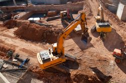
Without disturbing the land, ground penetrating radars send high-frequency radio pulses into the ground, mapping and creating images of deep subsurface locations. GPRs can be used to find both metallic and non-metallic objects, including conduits, rebar, or cables buried in 18 inches of concrete. Ground penetrating radars can also be used on the soil to take geologic profiles that detect underground features and layering. Due to the clarity of the feedback the GPRs receive, they can also identify potential instabilities, like sinkholes and fractures.
GPRs can scan soils with high salinity. However, due to their increased conductivity, the ground penetrating radar’s waves might become scattered. By keeping soil conductivity low, and conducting scans in dry seasons, ground penetrating radars can send their signals down further, often to 100 feet, and obtain clearer and more detailed pictures, increasing the safety and sustainability of any ongoing projects.
If you’re prepping a construction project on your residential or commercial property, reach out to Haggith’s Structural Scan & Inspection first. Dale Haggith and his experienced team can use their non-invasive ground penetrating radar to inspect the area for obstructions, saving you money before any work begins. Based in Honolulu, HI, and serving the entire island of Oahu, set up an inspection by calling (808) 239-4330. For more information on their services, including EM imaging, and utility scans, visit their website.
